3D Modelling of LIDAR Data
Mobile Applications
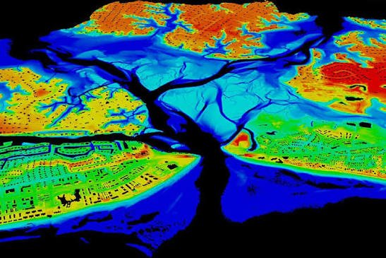
Topo Data, Imagery, LIDAR data (Point Clouds), Data processing. From your 3D data points, we can extract break lines (sharp changes in terrain). Do you have RGB camera images? We can do it for you – a stereo compilation to get a sense of depth and generate DSM, DEM products.

3D Modelling
Turn ideas into practical mobile applications with intuitive interfaces, reliable performance, and features shaped around everyday user needs.
GIS Solutions
Create detailed 3D models for visualisation, planning, presentation, and clearer understanding of complex spaces, products, and structures.

Our Solutions
Transform location data into useful maps, visual insights, and geographic tools that support smarter planning and informed decisions.
Our Solutions
Practical digital solutions – 3D models, and geographic visualisations – because geographic and non-geographic reality originates from processing of raw data.


